Closing the survey gap: how SatLab connects positioning, scanning and project decisions.
A bridge may be clearly visible from the air, yet the spaces beneath it can remain blank. SatLab’s published urban-mapping case shows why modern infrastructure surveys increasingly rely on connected technologies rather than a single instrument.
Survey technology is often discussed in terms of accuracy. On active roads, beneath bridges, inside industrial facilities or across water, however, completeness and continuity can be just as important. A precise measurement has limited value if the project team cannot connect it to the wider site record.
The case: filling the spaces an airborne survey could not see
In an urban-topography case published by SatLab, airborne laser-scanning data provided a broad view of an expressway and its surroundings, but it left incomplete information around roads, bridge structures, tunnels and the areas beneath elevated sections. This is a familiar limitation: objects block the sensor’s line of sight, creating gaps where engineers may need detail most.
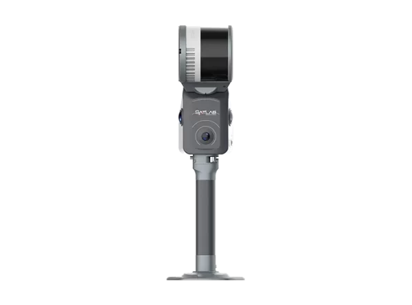
The project team supplemented the airborne data with a Cygnus SLAM scanner. A backpack configuration captured bridge piers and spaces beneath the overpass, while a vehicle-mounted arrangement collected the road and tunnel corridors. RTK observations helped place the mobile scans within an absolute coordinate system and served as a reference for accuracy. Where GNSS reception could be interrupted, control points and closed-loop collection strengthened the result.
The separate airborne, backpack and vehicle datasets were then brought into one coordinate framework and exported as a unified point cloud. The significance was not simply that more points were collected. The final dataset described the asset more completely, reducing the “holes” that could otherwise limit design, inspection or maintenance decisions.
No single sensor sees everything. A stronger survey combines the right instruments, common coordinates and a planned data workflow so each method fills the others’ blind spots.
Why the SatLab range matters
SatLab’s portfolio covers several stages of the geospatial workflow. Conventional GNSS RTK remains central for control, stakeout and mapping. Newer receivers add cameras, inertial measurement and lasers to make difficult points easier to reach. SLAM and LiDAR systems collect dense three-dimensional information while the operator moves. Total stations support optical control and construction layout. Hydrographic platforms extend positioning and sensing onto water. Field and office software tie these measurements together.
| Technology | Where it adds value |
|---|---|
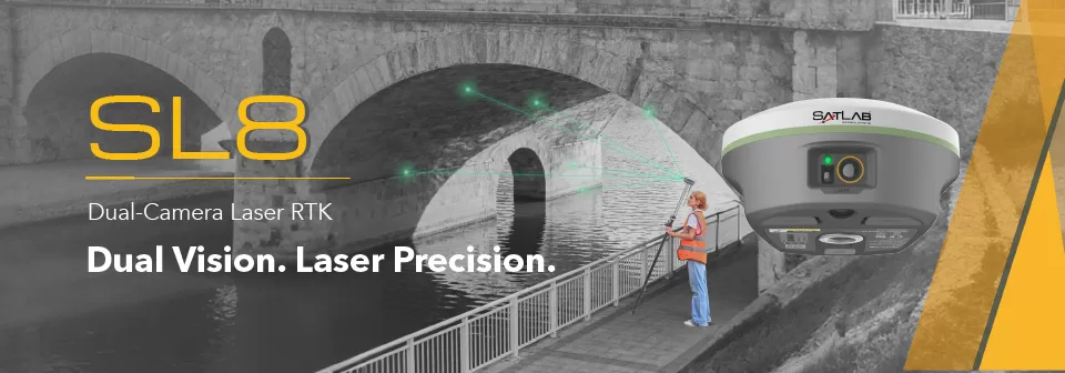
| SL8 Laser RTK | Non-contact point measurement, visual aiming and CAD-guided stakeout where a pole cannot be placed safely or directly. |
| SL9 SLAM RTK | Continuous measurement across open, covered and semi-indoor environments, with point-cloud and image-based workflows. |
| Cygnus 3 SLAM Scanner | Mobile 3D capture of facilities, corridors, stockpiles, structures and GNSS-challenged spaces. |
| SLT12 Total Station | Optical surveying, visual stakeout, construction control and documented field measurements. |
| HydroBoat systems | Bathymetry, underwater terrain, siltation, ports, channels, water flow and environmental monitoring with reduced personnel exposure on the water. |
| Satsurv and Sat-LiDAR | Field collection, visual guidance, point-cloud review, processing and the transfer of measurements into usable project outputs. |
| Machine control | Position-guided excavation, grading and earthworks where design levels must be carried into construction operations. |
Five benefits that reach beyond the survey team
More complete coverage
Combining point, image and point-cloud methods helps document locations that one viewing angle or one sensor may miss.
Fewer repeat visits
Field previews and quality checks can expose missing coverage while the team is still on site, before demobilisation.
Safer access
Laser measurement, mobile scanning and uncrewed survey vessels can reduce the need to place personnel at difficult or hazardous points.
Clearer coordination
Georeferenced outputs give owners, consultants, contractors and maintenance teams a common spatial record.
Better quantities and progress checks
Three-dimensional capture supports volume calculations, as-built comparison, earthworks review and progress documentation.
Data that can be reused
A well-controlled survey can support design, construction, inspection, asset management and later maintenance—not only the immediate task.
Where Kuwait projects can use the technology
- Roads, bridges and tunnels: topographic surveys, corridor mapping, construction stakeout, earthwork quantities and as-built verification.
- Utilities and municipalities: accurately positioned asset records, GIS data collection and documentation of surface and subsurface investigations.
- Oil, gas and industrial facilities: facility mapping, brownfield documentation, dimensional capture and support for modification planning.
- Ports, channels and water assets: bathymetry, dredging quantities, siltation monitoring, underwater-obstacle detection and reservoir or basin surveys.
- Construction and public works: layout, grade control, progress measurement, acceptance checks and digital handover records.
- Agriculture and land management: repeatable high-precision positioning for field machinery, mapping and resource-efficient operations.
Technology does not replace survey judgement
The benefit of a broad product range is choice, but choice also requires discipline. The correct method depends on the required accuracy, coordinate system, line of sight, satellite visibility, traffic or access restrictions, target density, environmental conditions and final deliverable. GNSS performance can be affected by obstruction and multipath; SLAM requires a suitable collection strategy; hydrographic accuracy depends on sensor integration and survey control.
That is why procurement should begin with the project question rather than the product name. The strongest specification defines what must be measured, the uncertainty that can be accepted, how quality will be verified and how the result must be delivered. Equipment, software, training and support can then be selected around that outcome.
A connected record is the real product
SatLab’s urban-mapping case is useful because it shifts attention away from a single impressive instrument. The outcome came from combining airborne coverage with backpack and vehicle scanning, anchoring the data spatially and merging the results into a usable whole. For road authorities, utilities, industrial operators and contractors, that connected record can become the basis for safer planning, clearer quantities, better maintenance decisions and more defensible project documentation.
Modern geospatial work is therefore less about choosing between GNSS, a total station or a scanner. It is about choosing the right combination—and ensuring the data survives beyond the day it was collected.
Official references
This feature draws on SatLab’s published case study and current product information. Performance and suitability must be verified for each project and operating environment.
SatLab — Cygnus SLAM Scanner in Urban Topographic Surveys ↗SatLab — SL8 Laser RTK Receiver ↗SatLab — SL9 SLAM RTK ↗SatLab — Cygnus 3 SLAM Scanner ↗SatLab — HydroBoat 1200 GEN2 ↗